
I left work frustrated and relieved. My boss had just told me that I could not take half a year off to hike. The frustration came because in my post trail depression, dreaming of another long hike was the only way I could get myself through each week. The relief came because it gave me freedom. I am a goal oriented person, a planner and one would probably say very type A. After the Pacific Crest Trail, I immediately set my sights on completing the triple crown, hiking the Appalachian Trail and the Continental Divide Trail. Not being able to do one of those, allowed me to let my eyes wander and check out other trials, shorter ones, that I COULD squeeze into a smaller summer break.
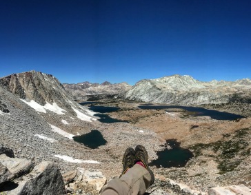
I looked into trails around 200-300 miles long. There was the Long Trail in Vermont that I wanted to save for peak foliage; the John Muir Trail with its challenging permits and nearly identical route to the PCT; and the Tahoe Rim Trail so close to home it didn’t feel like enough of a challenge. I wanted something that was going to push me and make me grow as a hiker. I started looking into the Sierra High Route, a route developed by Steve Roper that runs 195 miles mostly off trail through the sierra. The more I looked into it, the more I became sure that this is what I needed to do.
But the Sierra High Route was not quite enough. I decided I wanted something longer. I wanted to link it to the Southern Sierra High Route, a mostly off trail route at high elevation in the southern sierra developed by Alan Dixon. This would make my route 270 miles, basically maxing out the time I could take off work. I wanted to do this and I wanted to do it alone.
Navigating a Solo Journey
When I set out to hike the Pacific Crest Trail in 2017, I asked a few friends if they would go with me. I realized after the fact that I was not asking them for the right reasons. I was not asking them out of some desire to share my experience with them or to strengthen our friendship, I was asking them simply because I did not want to go alone. I was scared to go alone. They all said no. I then had to think about whether or not I still wanted to go, but I decided that hiking the PCT was something I wanted to do for me and that I would go anyway, alone. But I was not really alone. I made friends day one and had a trail family by mile 200 and, though I often hiked alone during the day, I was never truly alone. This time, unlike the PCT, I needed to go without the crutch of company and second opinions, and to do that my trip had to be a solo.
Going alone meant two things for me. One, it would give me time to be with myself. I have always joked that I could not make it two weeks alone. My friends and family joke about this too, but amid our laughs is some serious doubt about what I would do without human contact for two weeks. I often use other people for support and am constantly seeking the opinions of others to help me with my decision making. In some ways this is a skill, as it lets be build my knowledge and makes me an extremely honest and open person. But in other ways, it holds me back. This hike would mean being mostly alone for three weeks.
Two it would show me that I could do it. On the PCT, there were many times where I would leave tasks that challenged me up to others. It was not because I was incapable, but more because I it was easier to leave it to other people. This occasionally caused them to doubt my abilities and me to doubt myself. The main skill I did this with was navigation.
The navigation battle has really been an uphill challenge for me. I grew up thinking I was bad at navigating, because my little brother is an absolute genius navigator. He is one of those people that surfaces from an unfamiliar underground subway-stop immediately knowing where he is, one of those people that knows the layout of a new city within minutes. He is someone you can always count on to get you where you are trying to go. Needless to say, no one ever bothered to ask me for directions and in comparison I was atrocious. It took me until I was 19 to believe that maybe I had a fighting chance to get myself from point A to B on a new path all alone. What I realized was that if I paid attention, I could do it and I could actually do it pretty well. Despite finally appreciating my own ability, I still had a lot to do in terms of building confidence.
Leaving the trail
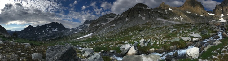
I had come a long way since then. I had hiked solo before on short trips, I had taught navigation classes, and used maps, compasses and GPS units in the field. This route would bring it all together; a solo journey mostly off trail doing my own navigating. I brushed up on my skills, began training, studied my maps and uploaded waypoints into my GPS.
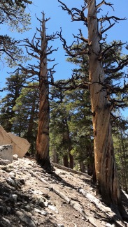
I set out on my hike from Cottonwood Lakes one June 23rd having only done one day of acclimatization. I left my friend at the trailhead and immediately felt free. I was on my own, going at my own pace. The trees were fantastic with their swirling trunks and I meandered through a network of well defined trails. It wasn’t long though until I started to worry. Should I be going this way? Should I have turned off a while back? I continued on trails for quite a ways and climbed my first pass, New Army Pass, ascending to above 12,000 feet. Tough rocky, the switchbacks were a clear trail, something I wouldn’t learn to appreciate as easy until later on. I breathed heavily as a I passed a chipper boy scout troupe on their descent. They asked me where I was going. The air felt thin. I manage to tell them about my plan and their eyes widened, we continued in opposite directions and I was alone again.other
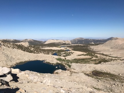
At the top of the pass I ran into a few more folks. These ones were clearly struggling with the elevation. I told them they were close and urged them to descend which seemed like the only thing they wanted to do anyway. Pausing, I quickly took note of my body. I was feeling sick too. I continued down the other side of the pass, leaving the trail for the first time and beginning my off trail travels. I sang as marmots pranced through the meadow below me. Later that night, I had to make a route decision but mosquitos swarmed in front of my face. The cloud of bugs was so thick it was hard to see my map and I kept accidentally inhaling them resulting in horrible coughing fits. Within a matter of seconds, I opted instead to pitch my bug net and go to bed right there. I would make my navigation decision in the morning.
Growing Pains
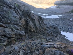
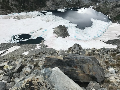
The next morning I looked at my map and promptly began to head too far to the right. I continued along this course until I hit a lake. I looked at my map. There was no lake where I was suppose to be. Maybe it is just a really wet area, I thought but even then I knew this was probably not true. It hadn’t even been that big of a snow year and this really looked like a lake, not just a wet area. I climbed up the hill northeast of it anyway. I climbed panting and sliding a bit backwards as the slope increased. I got to the top only to find another lake that was not on my map. Sitting on a large block of talus I looked at the map. I had gone the wrong way. I was frustrated and tired. I let out a loud growl for absolutely no one to hear but myself.
On the map, it was clear now that I was in a valley to the right of where I should be. I stood up and began my slog back down the hill. I looked at the passes that cut over to the valley I wanted to be in, but they were all extremely high and steep. I backtracked instead of improvising a new route. I tried to tell myself that it had at least be a beautiful waste of time, but my mind fought back reminding myself that I had known that I was in the wrong place when I first saw the lake and had stupidly continued. At this point I began using my GPS every so often to be sure that I was indeed where I wanted to be. No more pretending lakes aren’t lakes. I was tired.
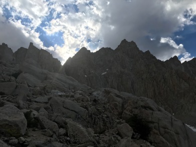
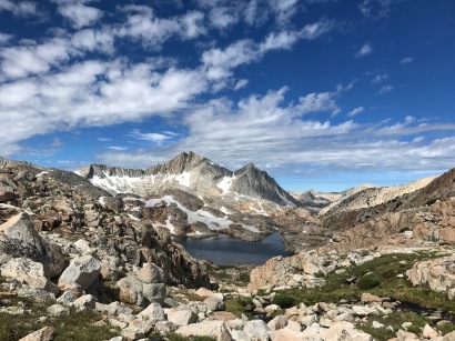
The route rewarded me with a series of tough climbs and descents only exacerbated by my mild altitude sickness. By the end of my second day I was ascending toward “trail crest” on the way up to Mount Whitney via an off trail route. I wanted to quit. This was something I had never felt before. I was done. Breathing was hard, I was having to force myself to eat due to mild nausea, and the climbs I was doing were terrifying for me. Or at least the one I had just finally managed to ascend was. It was a talus field that led to scree that just went straight up. From the bottom I thought for certain I would not be able to climb it, but I did. This was a feeling that I would get accustomed to on my route, being in a valley where every pass looks unconquerable and then several hours later finding myself at the top of one. But right now, I did not yet know that this was normal and I had to find a way down from the pass I was standing on. There were snow patches and steep drop offs decorating the side of my descent. Then, finally I saw it. The trail to Whitney. My desire to set foot on trail was so strong I began a more desperate search for a route through the rocks. Seeing one that looked like it would work I began my way down. Soon I was sitting on the edge of the trail.
I looked up to see people coming down the trial and smiled. Oh, dear its only day two and I am starving for human interaction, I thought. Behind them, a bunch of storm clouds gathered over the ridge. It was late in the day and the sky was growing grey and purple. I knew the right decision was to descend, even if it meant going up an extra 2000 feet the next day. I sat there for way too long thinking about it, but eventually decided to descend. I got down to “trail camp” for the night; my lungs enjoyed the little bit more oxygen and my mind enjoyed the proximity of people.
Never Quit on a Bad Day
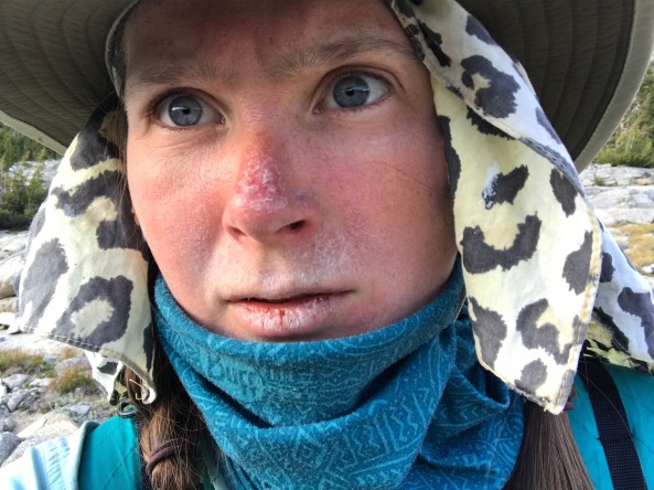
If you have hiked a long trail before, you have probably heard people say, “Never quit on a bad day.” As I hiked up Mount Whitney the next day, I couldn’t care less. I was hiking up Mount Whitney not because I cared about summiting the tallest mountain in the continental United States, but because I wanted to call home. I wanted to get permission to quit. This highlights one of the reasons I wanted to be alone in the first place. I have this odd tendency to ask others for permission to do things that are entirely my choice. I continued up the mountain almost crying, but feeling resolute in my decision to quit. I was not tough enough. This was an entirely new feeling for me and despite being someone who does not give up easily, all I wanted was to go home.
At the top of Whitney I began bawling and called home. When I had sobbed out every complaint, fear and worry I had, my mom responded, “You can’t quit for two days. If its too hard, you can change your plan and go down and hike on the Pacific Crest Trail or something, but you cannot come home for two days.” I wanted to protest, but that seemed smart. Deep down I knew that if I left, there was a big chance I would just come right back and try again. And if that was the case, the permits and rides would be a hassle to figure out again.
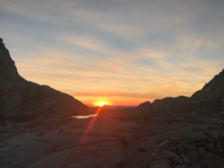
 I kept going and stubbornly stuck to my plan instead of descending to the PCT. This meant going down Mount Whitney’s Mountaineering Route. Having just met a hiker on the summit planning to take the same way down, we quickly agreed to go together and enjoyed the company of having someone else around. The climb down proved far more fun than scary. From the base I looked back up, shocked at what I had been able to come down. I called it an early night at Upper Boy Scout Lake. The water was beautiful and full of rainbow trout, the sunset played on the rocky mountain tops and someone gave me a bit of ravioli. Slowly my love for hiking returned and my body worked on acclimating.
The next morning I would go over Russell Col and have a very long day all alone off trail, but everything would be better. I would skinny dip and smile. I would curse and almost sprain my ankle. But I would no longer want to go home.
The rest of my hike would be like this, challenging and pushing me to my limit but rewarding and full of accomplishment. But for now I was at Upper Boy Scout Lake coming to terms with the fact that part of me was miserable and part of me was happy and once again the outdoors was feeling like my home.
Seeing Strength Through Struggle
It was the last day of my hike and I had a hard Class III scramble in front of me to get down from the pass I was standing on. I picked my hand holds carefully and pressed my body flat against the rock. The route description gave no real advice for this one except not to go down something unless you were sure it would work so that you didn’t get stuck. I was sure it would work. At the base, I looking back, I wondered if anyone else had chosen the route that I had. I had come to enjoy picking out routes through the rock, even if I sometimes picked challenging paths. They were mine, I picked them and I got to solve their puzzles. I loved that.
Turning to face the valley below me I stubbornly hugged the wall, walking over colorful rock fields to avoid having to gain elevation later. Sometimes I would become frustrated with this choice to not descend into the beautiful valley of full of easy walking, but I reminded myself that it had been my choice and I was alone to blame. I smiled then and trudged on through the rock, enjoying a birds-eye view of the valley below.
At the end of my hike, the last few miles were on a trail dotted with signs reminding you to “stay on trail”. This made me laugh. Gladly, I thought as I walked passed the signs. On trail, I was able to walk without thinking much about the actually walking. I let my mind reflect on my hike. To say this hike was easy for me would be a lie and to say that I have rid myself completely of self-doubt and that I no longer need outside support to achieve my goals would be an overstatement. But to say that I was able to see these struggles in myself for the first time with this much clarity would be true. It was seeing myself struggle that let me truly see my strength.
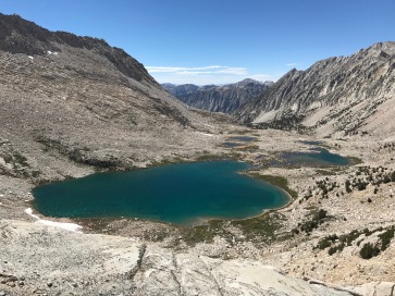
Despite the altitude sickness, the scrambling over talus, the time consuming route finding, the day-end loneliness and the races I had against thunderstorms, I had successfully finished my hike. I was strong and I was weak, I was perceptive and I was lost, I was lonely and I was independent, I was brave and I was not perfect. I was, standing at the end of my hike beside Twin Lakes, the only one responsible for my missteps and the only one responsible for my success. A whole new way of thinking opened up for me, I gave myself permission to struggle, to push my limits, to learn and to believe in my abilities.

Loved it. I read it twice. Insights & finding your way metaphorically & actually impressed me: the Orienteering the most of course 😏. Congratulations ‼️
LikeLiked by 1 person
Thank you! Definitely was a big adventure 😀
LikeLike